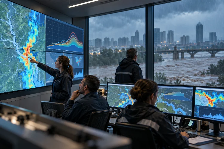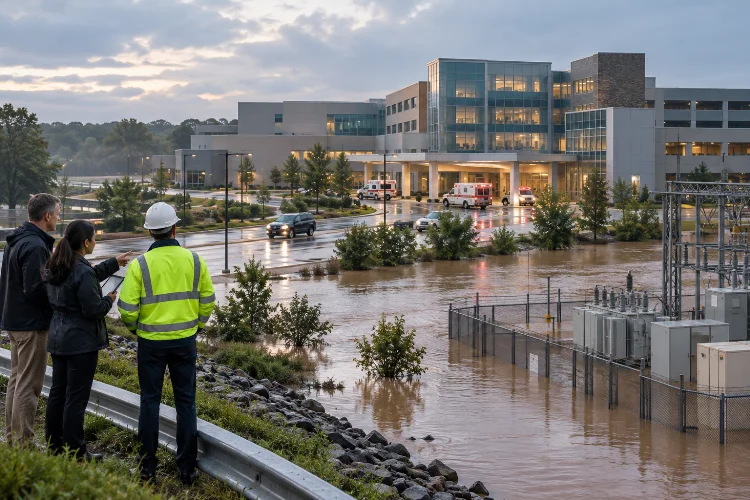
Imagine a city spending millions of dollars on flood barriers, drainage upgrades, and reinforced riverbanks, only to discover that an unusually intense storm still causes widespread flooding.
Frustrating, right?
The problem isn’t necessarily that the infrastructure was poorly designed. Sometimes, flood protection systems are evaluated against a limited number of scenarios that don’t capture the full complexity of real-world flooding.
Rainfall patterns change, rivers overflow unexpectedly, drainage networks become overwhelmed, and coastal water levels can rise at the worst possible moment.
This is where optimizing flood defense systems using multi-scenario simulations becomes incredibly valuable.
Instead of relying on a single design flood, engineers can test numerous combinations of weather conditions, hydraulic loads, infrastructure performance, and future environmental changes.
These simulations reveal how different protection strategies perform under both expected and extreme circumstances.
They also help planners balance construction costs, flood risk reduction, environmental considerations, and long-term infrastructure reliability.
In this guide, we’ll explore how multi-scenario hydraulic modeling works, which optimization techniques are most effective, and how engineers can design smarter flood protection strategies for increasingly uncertain conditions.
1. Why Traditional Flood Defense Planning Needs a Multi-Scenario Approach
Flood defense engineering has traditionally relied on selected design events.
For example, a levee might be designed to withstand a particular flood level associated with a specified annual exceedance probability.
This remains an important engineering approach, but real floods don’t always behave exactly like the events used in design calculations.
The Limitations of Single-Event Flood Modeling
A conventional flood study might simulate a river discharge associated with a 1% annual exceedance probability.
That corresponds to a 1-in-100 chance of exceeding the selected discharge in any given year, assuming the estimated probability remains applicable.
However, two storms with similar peak discharges can produce very different inundation patterns.
One event may involve a short, intense rainfall burst, while another lasts several days and produces a much larger total runoff volume.
Flood duration affects storage requirements, pumping operations, waterlogging, and the performance of drainage systems.
Similarly, downstream conditions can change the outcome.
High coastal water levels, elevated river stages, or saturated floodplains may reduce discharge efficiency and increase upstream flooding.
A single simulation cannot reliably represent every important combination of these conditions.
Understanding Multi-Scenario Flood Simulation
Multi-scenario analysis evaluates a collection of plausible hydraulic and environmental conditions.
Instead of asking whether a levee survives one selected flood, engineers examine how the entire protection system performs under different hazards and operating conditions.
For example, one simulation could represent moderate rainfall with functioning drainage pumps.
Another might represent extreme rainfall combined with restricted pumping capacity.
A third could investigate river flooding occurring alongside unusually high downstream water levels.
These scenarios help identify weaknesses that might remain hidden during conventional assessments.
The goal isn’t simply to generate hundreds of colorful flood maps.
It’s to understand which combinations of conditions create the greatest challenges and which interventions provide dependable protection.
2. Developing Realistic Flood Scenarios for Hydraulic Analysis
Before optimizing flood protection infrastructure, engineers need a well-designed scenario library.
This library represents the different conditions used to test the proposed system.
A good scenario framework should be broad enough to reveal important vulnerabilities without introducing unnecessary computational complexity.
Selecting the Most Important Flood Variables
Rainfall intensity is an obvious starting point, but it’s only one part of the problem.
Flood magnitude also depends on storm duration, rainfall distribution, soil moisture, catchment characteristics, and upstream storage.
River systems introduce additional variables, including channel roughness, sediment deposition, bridge restrictions, and reservoir discharge.
Coastal regions face further complications from storm surges, tides, and sea-level rise.
Infrastructure performance must also be considered.
A floodwall may experience overtopping, a pumping station may become unavailable, or a drainage channel may operate below its intended capacity.
These conditions should be selected based on credible failure mechanisms and site-specific evidence.
Creating a Scenario Matrix
Consider a hypothetical urban watershed protected by levees, detention ponds, and pumping stations.
Engineers could develop scenarios representing frequent rainfall events, severe river floods, and extreme compound events.
Each hazard scenario could then be evaluated under different infrastructure configurations.
For instance, the first configuration might represent the existing flood defense system.
A second could include upgraded pumps, while a third combines additional detention storage with targeted levee improvements.
Comparing the results reveals how effectively each improvement addresses the modeled hazards.
However, not every theoretical combination is physically realistic.
For example, rainfall, river discharge, and storm surge may be statistically dependent, so their joint occurrence should not automatically be estimated by multiplying independent probabilities.
Distinguishing Scenarios From Probabilities
This distinction is surprisingly important.
A collection of 50 simulations doesn’t necessarily describe 50 equally likely future events.
Some scenarios may represent relatively frequent conditions, while others are deliberately extreme stress tests.
When probabilities can be estimated credibly, they can support expected-loss calculations.
When probabilities are deeply uncertain, engineers can instead evaluate robustness across plausible futures.
Keeping these two approaches seperate prevents misleading interpretations of simulation results.
3. Building Accurate Hydrological and Hydraulic Simulation Models
Once the scenario framework is ready, the next step is transforming environmental conditions into realistic predictions of water movement.
This usually requires hydrological and hydraulic models working together.
Although they are closely related, these tools answer different questions.
Hydrological Modeling: Where Does the Water Come From?
Hydrological models estimate how precipitation becomes runoff and moves through a watershed.
They account for rainfall losses, soil infiltration, surface runoff, and channel routing.
Software such as HEC-HMS supports these processes and can generate discharge hydrographs for different storm scenarios.
A hydrograph represents how flow changes with time.
That’s important because flood protection systems respond not only to peak discharge but also to the timing and volume of incoming water.
A long-duration event might overwhelm detention storage even when its peak discharge is lower than that of a shorter storm.
Hydraulic Modeling: Where Will the Water Go?
Hydraulic models calculate how water travels through rivers, drainage channels, and floodplains.
One-dimensional models work well when water movement follows relatively defined channels.
Two-dimensional models provide more detailed representations of overland flow.
HEC-RAS supports both approaches, including combined 1D/2D simulations, levee overtopping, breaching scenarios, hydraulic structures, and inundation mapping.
These capabilities help engineers evaluate flood depth, velocity, water surface elevation, and the timing of inundation.
For an urban area, a two-dimensional simulation may reveal that floodwater bypasses a new barrier through a low-lying road.
Such a pathway might be overlooked when the analysis concentrates only on the main river channel.
Improving Terrain and Mesh Accuracy
Reliable hydraulic predictions depend heavily on accurate topography.
Digital elevation models, LiDAR surveys, river bathymetry, and infrastructure records help define how water moves through the landscape.
Computational meshes should represent important structures, such as levees, culverts, floodwalls, and road embankments.
Finer cells are often useful near complex flow pathways, while larger cells may be acceptable in relatively uniform floodplain areas.
However, greater resolution increases computational demand.
Mesh sensitivity testing helps determine whether additional detail materially changes important predictions.
Proper model calbration using observed flood levels, flow measurements, and historical inundation evidence is equally essential.
4. Comparing Structural and Nature-Based Flood Defense Solutions
Flood protection involves more than constructing taller levees.
Modern risk management often combines engineered structures, operational measures, land-use planning, and natural floodwater storage.
Multi-scenario simulations help determine how these components interact.
Evaluating Levees, Floodwalls, and Pumping Systems
Levees and floodwalls are designed to reduce the frequency or extent of flooding in protected areas.
However, their performance depends on structural conditions, hydraulic loading, foundation behavior, and possible overtopping or failure.
Pumping stations provide another form of protection by moving water from low-lying areas when gravity drainage is insufficient.
Yet pumping capacity can become a bottleneck during intense rainfall.
Imagine a protected neighborhood where rainfall accumulates behind a levee while downstream river levels remain high.
Even if the levee prevents river water from entering, inadequate interior drainage may still cause serious flooding.
This demonstrates why engineers need to simulate the entire protection system rather than evaluating each structure individually.
Incorporating Natural Flood Management
Nature-based measures can complement conventional engineering infrastructure.
Examples include restored wetlands, floodplain reconnection, detention areas, rain gardens, and permeable surfaces.
These measures can reduce runoff, temporarily store water, and improve infiltration under suitable conditions.
However, their effectiveness depends on available storage, soil properties, storm duration, maintenance, and local geography.
A detention pond may substantially reduce flooding during moderate storms but provide limited additional benefit once it reaches capacity.
Similarly, wetlands shouldn’t automatically be assumed to replace engineered protection against every extreme event.
Multi-scenario analysis helps establish where these measures are most effective.
Understanding Interactions Between Defense Measures
Flood defense components don’t always operate independently.
Raising one levee section can redirect water toward another location, potentially increasing downstream or opposite-bank flood levels.
Likewise, modifying a drainage outlet can change how quickly water accumulates behind a barrier.
A study by van Berchum and colleagues, published in the Journal of Flood Risk Management, introduced the Multiple Lines of Defence Optimization System.
The research demonstrated how combinations of structural and nonstructural interventions could be evaluated while accounting for interactions between protection measures.
This systems-based approach is especially valuable for complicated coastal and urban environments.
5. Optimizing Flood Defense Investments Across Multiple Scenarios
Running simulations is only the beginning.
The real challenge is deciding which flood protection strategy delivers the greatest overall benefit.
That’s where mathematical optimization and risk-based decision-making become useful.
Defining Multiple Optimization Objectives
Flood defense planning typically involves competing objectives.
Decision-makers want to reduce flood damage, protect lives, control construction costs, and limit environmental impacts.
Unfortunately, improving one objective may sometimes make another worse.
For example, a large concrete floodwall might reduce inundation but introduce environmental or visual impacts.
Alternatively, extensive detention storage might deliver ecological benefits while requiring substantial land acquisition.
Multi-objective optimization helps planners compare these trade-offs systematically.
Methods such as genetic algorithms, mixed-integer programming, and direct policy search can explore different combinations of design variables.
Their suitability depends on the mathematical problem, available computational resources, and required accuracy.
Comparing Flood Protection Alternatives
Consider a hypothetical city with an existing expected annual flood damage estimate of $4 million.
Engineers are evaluating two improvement packages.
Alternative A combines drainage upgrades with additional detention capacity. Its estimated construction cost is $18 million, and simulations suggest that expected annual damage could decrease to $2.5 million.
Alternative B includes larger pumping upgrades and reinforced flood barriers. Its estimated construction cost is $36 million, with expected annual damage declining to $1.8 million.
Alternative B provides greater estimated damage reduction but also requires substantially more investment.
Alternative A may offer a better return under certain budget conditions.
However, a proper comparison should use discounted lifecycle costs, maintenance expenses, uncertainty ranges, and relevant nonmonetary consequences.
These numbers are illustrative, not results from an actual engineering study.
Using Expected Annual Damage
Expected Annual Damage, commonly abbreviated as EAD, measures average annual economic flood losses under a defined probability model.
The USACE HEC-FDA methodology combines flood frequency, water levels, and damage relationships to calculate this metric.
Rather than evaluating one design event, EAD considers losses across a range of flood severities.
This makes it especially useful when comparing protective alternatives.
However, economic calculations should never become the only decision criterion.
Potential loss of life, emergency access, infrastructure dependencies, and community vulnerability require appropriate consideration.
Finding the Pareto-Optimal Solutions
In multi-objective optimization, a Pareto-optimal solution is one that cannot improve one objective without worsening at least one other objective.
The collection of these solutions is called the Pareto frontier.
For example, one alternative may be inexpensive but provide modest flood reduction.
Another may offer stronger protection at a considerably higher cost.
A third could balance cost, resilience, and environmental benefits.
The Pareto frontier helps decision-makers understand these trade-offs without pretending that one solution is automatically best for everyone.
Recent research by Wang and Johnson (2026) also demonstrates how adaptive optimization and scenario reduction can support risk-based levee planning under uncertain future conditions.
6. Managing Climate Uncertainty and Long-Term Flood Resilience
Flood defense systems are often expected to operate for several decades.
During that time, rainfall patterns, land development, coastal conditions, and infrastructure exposure may change.
A strategy that performs well today might become less effective in the future.
Testing Future Climate and Development Scenarios
Climate-sensitive flood modeling examines how plausible changes in environmental conditions could affect hydraulic performance.
Scenarios might include changes in extreme precipitation, sea-level rise, land subsidence, or watershed urbanization.
The IPCC Sixth Assessment Report highlights the importance of managing interacting climate hazards and infrastructure vulnerabilities.
However, future flood changes vary across regions, and uncertainty must be evaluated locally.
Engineers should avoid assuming that one climate projection represents the guaranteed future.
Instead, testing multiple plausible futures helps identify strategies that remain effective under different conditions.
Applying Robust Decision-Making
Traditional optimization may seek the best result for a particular assumed future.
Robust decision-making focuses on solutions that perform acceptably across many plausible futures.
This distinction is valuable when future rainfall or development cannot be predicted confidently.
For example, a modular floodwall designed for future heightening may offer advantages over a system that is expensive to modify.
The initial design may not provide maximum protection under every possible scenario.
However, its adaptability can reduce the risk of becoming unsuitable as conditions change.
Dynamic Adaptive Planning
Dynamic Adaptive Policy Pathways provides a framework for planning interventions that can change over time.
Research by Haasnoot and colleagues explains how long-term strategies can combine initial investments with monitoring indicators and future adjustment options.
For flood management, these indicators might include rising flood levels, changing land use, or increasing frequency of drainage exceedances.
When a defined threshold is reached, additional protective measures can be evaluated or implemented.
This approach can improve long-term resiliance by avoiding unnecessary early investment while preserving future options.
However, adaptability requires continuous monitoring, clear institutional responsibilities, and realistic implementation schedules.
7. Turning Simulation Results Into Practical Flood Protection Decisions
A sophisticated hydraulic simulation doesn’t automatically produce a successful flood protection project.
Engineers must translate model results into decisions that local authorities, infrastructure owners, and communities can understand.
This requires a structured evaluation process.
Establishing Meaningful Performance Indicators
Maximum water depth is important, but it shouldn’t be the only metric.
Flood protection performance can also be evaluated using flood velocity, inundation duration, exposed population, expected economic damage, and disruption of essential services.
For example, two alternatives might produce similar maximum flood depths.
However, one might shorten flooding duration from several days to a few hours.
That difference could substantially reduce building damage, transportation disruption, and recovery costs.
Emergency access and the ability to maintain electricity or water supply may also influence which alternative is preferable.
Validating Results and Managing Uncertainty
Model validation should include independent historical events whenever suitable observations are available.
Engineers should compare predicted flood levels, hydrographs, inundation extents, and arrival times with observed evidence.
Sensitivity analysis helps reveal which assumptions most strongly influence results.
For example, uncertainties in terrain elevation, channel roughness, pump availability, and breach characteristics may significantly affect predicted flooding.
A credible study should document these uncertainties rather than presenting model outputs as exact predictions.
Improving Computational Efficiency
Large scenario libraries can become computationally expensive.
Instead of running every possible combination at the highest resolution, engineers can use a staged approach.
Simplified models may screen large numbers of alternatives, while detailed two-dimensional simulations evaluate the most promising designs.
Scenario reduction techniques can also help select representative conditions without discarding important extremes.
However, screening methods must be tested to ensure they preserve the scenarios relevant to decision-making.
The result should be faster analysis without sacrificing essential hydraulic accuracy.
Communicating Results Clearly
Flood maps, comparative charts, and scenario dashboards make complicated results easier to interpret.
Decision-makers should be able to see which neighborhoods benefit, where residual flooding remains, and how alternatives compare.
An improvement that protects a commercial district but increases flooding in nearby residential areas deserves careful scrutiny.
Community engagement and enviromental considerations should therefore be included throughout the planning process.
Finally, optimization results should guide qualified engineering decisions, not replace regulatory reviews, structural safety assessments, or emergency planning.
The strongest flood defense strategies combine numerical evidence with professional judgment and practical implementation requirements.
Optimizing flood defense systems requires more than designing infrastructure for one extreme storm.
Multi-scenario simulations allow engineers to evaluate how levees, floodwalls, pumping stations, drainage networks, and nature-based solutions perform under different hydraulic and environmental conditions.
By combining hydrological modeling, two-dimensional flood simulation, uncertainty analysis, and multi-objective optimization, planners can identify more reliable protection strategies.
These methods also help balance construction costs, residual flood risk, community safety, and long-term adaptability.
However, their effectiveness depends on accurate data, credible scenarios, proper validation, and transparent decision-making.
The goal isn’t to eliminate every possible flood, but to reduce consequences and build systems that can adapt to changing hazards.
Ready to improve your flood defense strategy? Start by reviewing existing hydraulic models, developing a realistic scenario library, and comparing alternative protection measures across multiple flood conditions.
These steps can support smarter infrastructure investment and stronger community resilience.