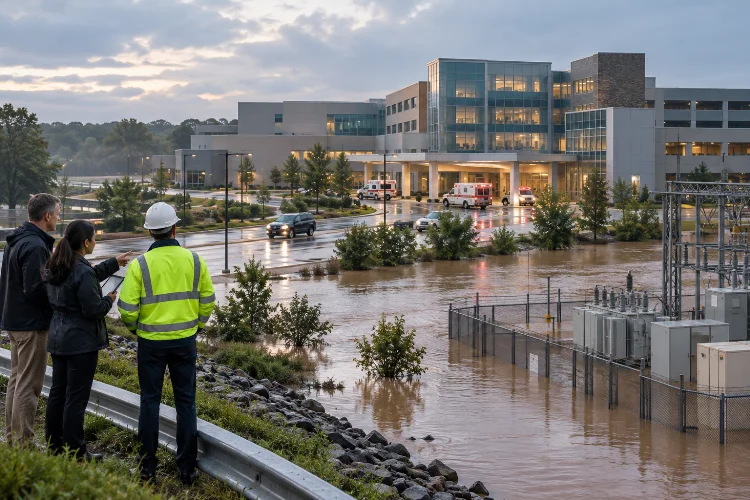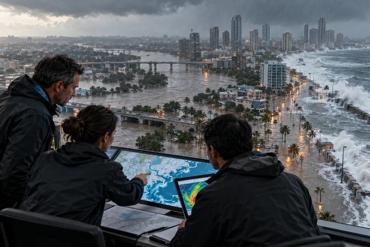
Imagine a coastal city experiencing heavy rainfall while a powerful storm pushes seawater toward the shoreline. Rivers begin rising, drainage systems struggle to move water, and neighborhoods that rarely flood suddenly find themselves underwater.
Now imagine trying to predict that entire situation using a model that only considers river discharge.
Sounds pretty limiting, right?
That’s one of the biggest challenges in modern flood management. Flooding rarely follows a single, predictable pathway. Instead, rainfall, river flow, coastal water levels, urban drainage, and surrounding terrain can interact in complicated ways.
This is where advanced flood risk modeling using coupled hydrodynamic systems becomes particularly valuable.
Rather than examining each flooding process independently, coupled models connect different simulation components to better represent how water moves across an interconnected environment.
Engineers can use these systems to evaluate flood depths, inundation areas, flow velocities, and potential impacts on infrastructure.
In this guide, we’ll explore how coupled hydraulic models work, which technologies support them, and how engineers can create more reliable flood predictions for complex river basins, urban areas, and coastal communities.
1. Understanding Coupled Hydrodynamic Systems in Flood Modeling
Traditional flood models have provided valuable insights for decades.
However, many were developed to represent specific processes, such as rainfall runoff, river discharge, or coastal water movement.
While these specialized models remain useful, relying on them individually can overlook important interactions.
What Is a Coupled Hydrodynamic Model?
A coupled hydrodynamic system connects two or more numerical models so they can exchange information about water movement.
For example, a rainfall-runoff model might estimate water entering a river network, while a hydraulic model calculates how that discharge changes water levels and inundates surrounding land.
When connected properly, the models can represent a broader range of flooding processes.
Some frameworks use one-way coupling, where information moves from one model to another.
Others employ two-way coupling, allowing changes in one component to influence calculations in the other.
A river model might pass discharge into a floodplain model, while the floodplain model returns water-level information that influences flow across the connection.
The appropriate coupling method depends on the physical problem, available software, and required accuracy.
Why Independent Models Can Miss Important Details
Consider a river flowing into a coastal estuary.
During normal conditions, river discharge moves downstream toward the sea.
However, elevated coastal water levels can create backwater effects, reducing the hydraulic gradient and raising river stages upstream.
A river model using an unrealistic fixed downstream boundary might underestimate this interaction.
Similarly, an urban drainage model that ignores surface flooding may fail to represent water overflowing from manholes and travelling through streets.
Connecting the relevent components provides a more complete understanding of these processes.
The result isn’t automatically perfect, but it offers an opportunity to represent interactions that simpler modeling approaches cannot adequately capture.
2. Combining 1D and 2D Hydraulic Models for Better Flood Predictions
One of the most widely used approaches in computational flood engineering is combining one-dimensional and two-dimensional hydraulic simulations.
Each method has advantages, and bringing them together can improve both computational efficiency and spatial detail.
How 1D Hydraulic Models Work
A one-dimensional hydraulic model represents flow primarily along a defined direction, typically the centerline of a river or drainage channel.
Water levels and discharge are calculated using cross-sectional information, channel roughness, hydraulic structures, and boundary conditions.
This approach works particularly well for relatively narrow river networks and reaches where longitudinal flow dominates.
It is also computationally efficient compared with resolving the same entire domain at high two-dimensional resolution.
However, problems arise when water spreads across broad floodplains or moves in several horizontal directions.
Under those conditions, a more detailed spatial representation may be necessary.
Why 2D Models Add Valuable Detail
Two-dimensional hydraulic models calculate horizontal flow movement across a computational mesh.
They commonly solve the shallow-water equations or suitable approximations.
This allows engineers to represent how water spreads through floodplains, moves around buildings, and travels across complicated terrain.
For example, a two-dimensional model can show how floodwater enters an urban neighborhood through a low-lying road and gradually fills surrounding depressions.
It can also estimate spatial variations in flood depth and velocity.
These details are useful for infrastructure design, emergency planning, and flood hazard mapping.
Connecting 1D Rivers With 2D Floodplains
A combined 1D–2D model uses one-dimensional representations where flow is predominantly channelized and two-dimensional calculations where lateral spreading is important.
HEC-RAS, developed by the US Army Corps of Engineers, supports this type of integrated hydraulic modeling.
Connections can represent exchanges between river reaches, floodplain areas, storage areas, and hydraulic structures.
For instance, when river levels exceed a levee or natural bank elevation, water can pass into an adjacent two-dimensional floodplain.
Accurate results depend on correct connection geometry, compatible elevations, appropriate hydraulic coefficients, and stable numerical calculations.
A poorly configured interface can introduce errors even when the individual model components appear reasonable.
3. Integrating Rainfall, Urban Drainage, and Coastal Flooding
Flooding becomes especially complicated when several water sources affect the same area.
An intense storm might generate surface runoff, overwhelm underground drainage networks, and coincide with high coastal water levels.
These interactions are commonly discussed under the term compound flooding.
Connecting Rainfall-Runoff and Hydraulic Models
Hydrological models estimate how rainfall becomes runoff.
Their calculations may consider infiltration, soil conditions, land cover, watershed characteristics, and drainage pathways.
Hydrodynamic models then calculate how the resulting water moves through rivers, channels, or floodplains.
Coupling these processes allows engineers to investigate the relationship between storm intensity and flood inundation.
For example, two rainfall events with the same total precipitation can create very different flood responses.
A short, intense storm may overwhelm urban drainage capacity, while a longer event can saturate soils and generate prolonged river flooding.
Antecedent soil moisture and rainfall distribution therefore matter alongside total rainfall.
Modeling Urban Drainage Networks
Urban areas present additional challenges because water moves through both underground infrastructure and surface pathways.
The US Environmental Protection Agency’s Storm Water Management Model (SWMM) is widely used to simulate runoff and drainage-network behavior.
When appropriately linked to a two-dimensional surface-flow model, it can support dual-drainage analysis.
This allows engineers to investigate water entering drains, moving through pipes, and potentially returning to the surface when the network becomes surcharged.
However, SWMM alone should not be confused with a complete high-resolution 2D surface inundation model.
The surface component and exchange rules must be implemented through an appropriate integrated modeling framework.
Understanding Compound Coastal Flooding
Coastal flooding introduces additional variables, including astronomical tides, storm surge, waves, and river discharge.
According to NOAA, these processes can interact and amplify flooding in coastal communities.
Imagine heavy upstream rainfall sending a large flood wave toward an estuary just as coastal water levels rise.
The combined conditions may increase upstream water levels and prolong inundation.
Research published in Natural Hazards and Earth System Sciences in 2023 demonstrated a framework connecting river-routing, coastal boundary conditions, and a high-resolution inundation model.
The study simulated historical flooding associated with Tropical Cyclones Idai and Eloise in Mozambique.
It showed the importance of considering multiple flood drivers and their timing.
Importantly, compound flooding does not always require the maximum river discharge and maximum coastal water level to occur at precisely the same moment.
The timing and duration of each event can strongly influence the final flooding outcome.
4. Building Accurate Models With Reliable Data and Numerical Methods
A sophisticated coupled model can still produce misleading results when its input data is inaccurate.
Before running simulations, engineers must establish a reliable representation of the physical environment.
Why Terrain and Bathymetry Matter
Terrain elevation controls where floodwater can travel.
Digital Elevation Models (DEMs), LiDAR surveys, and river bathymetry provide important information about land surfaces and underwater channel geometry.
Small elevation differences may determine whether water remains inside a riverbank or enters a nearby residential area.
For example, a road embankment might prevent floodwater from reaching a neighborhood.
If the terrain model fails to represent that embankment, predicted inundation extents could be significantly different.
Likewise, bridges, culverts, walls, and drainage openings may require explicit representation.
High-resolution terrain data is especially useful in urban areas, although the appropriate resolution depends on the modeling objectives.
Designing an Efficient Computational Mesh
Two-dimensional simulations divide the study area into numerical cells.
Smaller cells can capture local variations in terrain and flow, but they increase computational demands.
Instead of using an extremely fine grid everywhere, engineers can apply selective mesh refinement.
Areas around bridges, narrow flow pathways, embankments, and critical infrastructure may require additional detail.
Relatively uniform floodplain sections can often use larger cells.
Deltares’ D-Flow Flexible Mesh supports flexible grid arrangements and local refinement for different hydrodynamic applications.
The goal is to achieve sufficient spatial accuracy without creating unnecessary computational costs.
Managing Boundary Conditions and Model Coupling
Boundary conditions describe how water enters, leaves, or interacts with the modeled domain.
Typical inputs include discharge hydrographs, rainfall, coastal water levels, and operating conditions at hydraulic structures.
For coupled systems, boundary conditions must also be consistent across model interfaces.
Imagine one component updating discharge every five minutes while another resolves rapid flow changes at a much shorter time step.
The coupling framework must exchange or interpolate information appropriately without introducing unacceptable mass-balance errors.
Engineers should monitor continuity, flow stability, and numerical convergence throughout the simulation.
Coupling more models is only useful when the connections between them accurately represent the physical system.
5. Calibration, Validation, and Uncertainty Analysis
Once the coupled simulation is running, the next challenge is determining whether its predictions are trustworthy.
Realistic-looking flood maps don’t necessarily indicate accurate results.
Hydraulic models require systematic testing against observed conditions.
Calibrating Model Parameters
Calibration involves adjusting uncertain parameters within physically reasonable limits to improve agreement with observations.
These parameters may include channel roughness, floodplain resistance, infiltration characteristics, and drainage coefficients.
Suppose observed water levels at a monitoring station reach 3.4 meters during a historical flood.
If the simulation consistently predicts 3.0 meters, engineers need to investigate the disagreement.
Possible explanations include incorrect discharge inputs, terrain errors, unsuitable roughness values, or inaccurate downstream conditions.
Changing roughness alone may improve the match while concealing a different underlying problem.
Good calbration requires understanding why the model behaves as it does.
Validating Against Independent Flood Events
Validation tests the calibrated model using observations not employed during parameter adjustment.
Useful evidence includes river-gauge measurements, surveyed high-water marks, satellite-derived flood extents, and recorded inundation depths.
Engineers can compare water-level errors, flood arrival times, and spatial inundation patterns.
Metrics such as root mean square error, critical success index, and false-alarm ratio can help evaluate performance.
However, different measures reveal different weaknesses.
A model may reproduce water levels accurately at one station while predicting flooding across the wrong streets.
Therefore, validation should consider several types of observations.
Quantifying Uncertainty
Every flood prediction contains uncertainty.
Rainfall forecasts, hydraulic roughness, terrain measurements, boundary conditions, and numerical approximations can all influence the final results.
A US Geological Survey publication examining uncertainty in flood inundation maps highlights the significance of hydrologic, topographic, and hydraulic-model inputs.
Instead of presenting one flood boundary as an unquestionable prediction, engineers can investigate multiple plausible scenarios.
For example, varying rainfall intensity or downstream water elevation can reveal how sensitive a neighborhood’s predicted flooding is to uncertain conditions.
This is particularly valuable when making decisions about expensive infrastructure investments.
6. Turning Flood Hazard Simulations Into Risk Assessments
Predicting floodwater movement is only part of flood risk management.
To understand potential consequences, engineers must connect simulated hazards with the people, buildings, infrastructure, and activities located within affected areas.
Understanding Hazard, Exposure, and Vulnerability
Flood hazard describes characteristics such as inundation depth, velocity, duration, and likelihood.
Exposure identifies what is located in areas that may flood.
Vulnerability describes how severely those exposed assets or populations could be affected.
For example, two neighborhoods might experience the same predicted water depth.
However, their consequences could differ considerably because of building characteristics, critical facilities, evacuation options, and social vulnerability.
A flood hazard map therefore isn’t automatically a complete flood risk map.
Evaluating Multiple Flood Scenarios
Coupled models allow engineers to test different combinations of hydraulic and environmental conditions.
Consider a hypothetical coastal city examining three scenarios.
The first involves extreme river discharge under typical tidal conditions.
The second combines moderate river flow with elevated coastal water levels.
The third introduces heavy local rainfall while downstream water levels remain high.
Each scenario may create a different spatial flooding pattern.
By comparing results, planners can identify locations vulnerable to river overflow, poor drainage, coastal backwater, or combined effects.
However, individual scenarios do not automatically establish annual flood probabilities.
Probabilistic risk assessments require appropriate statistical treatment of storm frequency, dependencies among flood drivers, and possible combinations of events.
Supporting Practical Flood Mitigation Decisions
Once flood depths and velocities are available, planners can compare mitigation alternatives.
Potential strategies include improved drainage systems, flood barriers, detention basins, elevated roads, and natural floodplain restoration.
For example, a coupled simulation might reveal that expanding a stormwater pipe provides limited benefit when high downstream river levels prevent discharge.
This could encourage evaluation of additional storage or controlled pumping.
The model helps identify how proposed interventions change hydraulic behavior.
Economic, environmental, maintenance, and social considerations are still needed before selecting a final solution.
7. A Practical Workflow for Large-Scale Flood Modeling Projects
Let’s bring everything together with a practical example.
Imagine an engineering team studying a rapidly developing coastal city where river flooding, heavy rainfall, and tidal backwater regularly threaten residential and industrial areas.
The team wants to understand current flooding conditions and evaluate future mitigation strategies.
Step 1: Define the Modeling Objectives
The project begins by identifying the decisions that the simulation needs to support.
The team wants to estimate maximum flood depths, inundation extents, critical road closures, and potential drainage-system failures.
These objectives guide data requirements and determine which modeling components are necessary.
Step 2: Develop the Coupled Model
A rainfall-runoff model generates flow entering the main river network.
A one-dimensional hydraulic model represents the river channels, while a two-dimensional model simulates floodplain and urban surface flow.
A separate drainage-network model is connected where pipe–surface interactions are important.
Coastal water levels provide a time-varying downstream boundary.
The engineers carefully check how the individual components exchange water and how their numerical time steps interact.
Step 3: Reconstruct Historical Floods
Before evaluating future scenarios, the team simulates one or more observed flood events.
Historical rainfall data, river measurements, tide records, and documented flood locations provide validation evidence.
Suppose the initial model predicts flooding in several locations where no inundation was recorded.
The engineers review terrain connectivity, drainage assumptions, and boundary conditions before changing model parameters.
They also investigate whether missing observations or timing differences explain the discrepancy.
Step 4: Test Future Flood Conditions
Once the model demonstrates acceptable performance, the team evaluates additional scenarios.
These could include changes in rainfall intensity, land development, coastal water levels, and drainage infrastructure.
Climate-informed scenarios can help assess the consequences of changing environmental conditions.
However, future projections should be linked to documented assumptions rather than treated as exact predictions.
The occurence of a particular flood scenario and its probability are different questions.
Step 5: Communicate Results Clearly
Finally, simulation outputs are converted into practical information.
Flood maps show expected inundation depths, while velocity information identifies potentially dangerous flow pathways.
Infrastructure overlays help highlight exposed roads, hospitals, substations, and water-treatment facilities.
Decision-makers also receive uncertainty information and explanations of the assumptions behind each scenario.
This makes the results more useful for planning than a collection of complicated numerical outputs alone.
The Future of Coupled Flood Modeling
Emerging technologies are expanding the possibilities for integrated flood simulation.
Cloud computing, faster numerical solvers, remote sensing, and automated workflows can support increasingly complex regional models.
Machine learning may also help estimate model outputs, identify patterns, or accelerate selected computational tasks.
Digital twins offer another potential approach by linking hydraulic simulations with updated observations.
However, these developments still depend on robust physical modeling, accurate data, and proper validation.
The future isn’t simply about running bigger simulations.
It’s about producing better information that communities can understand and use before flooding becomes a disaster.
Advanced flood risk modeling using coupled hydrodynamic systems provides a more comprehensive way to understand how water moves through rivers, cities, and coastal environments.
By connecting rainfall-runoff, hydraulic, drainage, and coastal models, engineers can explore interactions that traditional standalone simulations may overlook.
Accurate terrain data, reliable boundary conditions, careful calibration, and uncertainty analysis remain essential for producing meaningful results.
More importantly, coupling flood hazard predictions with exposure and vulnerability information helps decision-makers identify practical mitigation priorities.
Ready to improve your flood modeling strategy? Start by evaluating the interactions your existing models may be missing, then identify where additional coupling could provide the greatest benefit.
A well-designed integrated modeling approach can support smarter infrastructure planning, stronger flood preparedness, and more resilient communities.